
Search a Chattanooga Street Directory
A street search works best as a chain, not as a claim that one screen names everyone on a road. Hamilton County's Assessor can return the parcels that match a street name. The Trustee adds tax-record context. GISMO and ZIMS place the parcels on the map. The Register of Deeds can connect a parcel or sale reference to recorded parties and documents. A historical directory may identify a person listed at the address in one dated edition. Each source describes a different relationship to the address.
- Search the Hamilton County Assessor Property Search by street name. Add the street number when the road-name result is broad, and save the parcel or map reference for the selected property.
- Check the parcel against the Trustee Property Tax Inquiry. Keep the property address, owner field, and mailing address in separate notes.
- Use Hamilton County Geospatial Technology's mapping entry page to locate the parcel and inspect the visible street and parcel layers.
- Where a sale cue or book and page is available, use the Register's account search or the counter to identify the recorded instrument and its parties. Log the legal description with the street address.
- For a dated historical listing, consult the Local History collection's relevant city-directory edition. Treat that listing as evidence for that edition date, not a current-person result.
Chattanooga Assessor, Chattanooga Trustee, Chattanooga GISMO, Chattanooga ZIMS, Chattanooga Register, Chattanooga City, and Chattanooga Library sources each keep a separate part of the address trail.
Note: Street-by-street research is stronger when every result is labeled as parcel, tax, recorded-party, or historical-listing evidence.
Chattanooga Street Directory Assessor Search
The free Assessor form is the local starting point for a named road. One complete field is required. A Street Name search can retrieve a whole matching street, while Street Number narrows it to an address. The Help guidance warns that a short name can overmatch, such as a road name inside a longer road name. Use the stored suffix and the number before deciding that a result belongs to the address in hand. Owner input uses one last-name-first field and permits partial text, but joint ownership can be indexed under the first deed owner only.
| Assessor field | Entry type | When to use it | Local format note |
|---|---|---|---|
| Street Name | Text | Road-wide or address search | One complete field is required; include the suffix to narrow an overmatch. |
| Street Number | Text | With a street name | Targets a particular numbered address. |
| Parcel | Text | Known parcel search | Use spaces and decimal marks exactly as shown on an assessment notice. |
| Owner | Text | Known recorded-owner search | Enter last name first; a later-listed joint owner may not retrieve the record. |
The Assessor search view shown below is the current entry point. A street result supplies assessment context rather than a complete resident list, and the county says its assessment maps are not conclusive legal ownership.
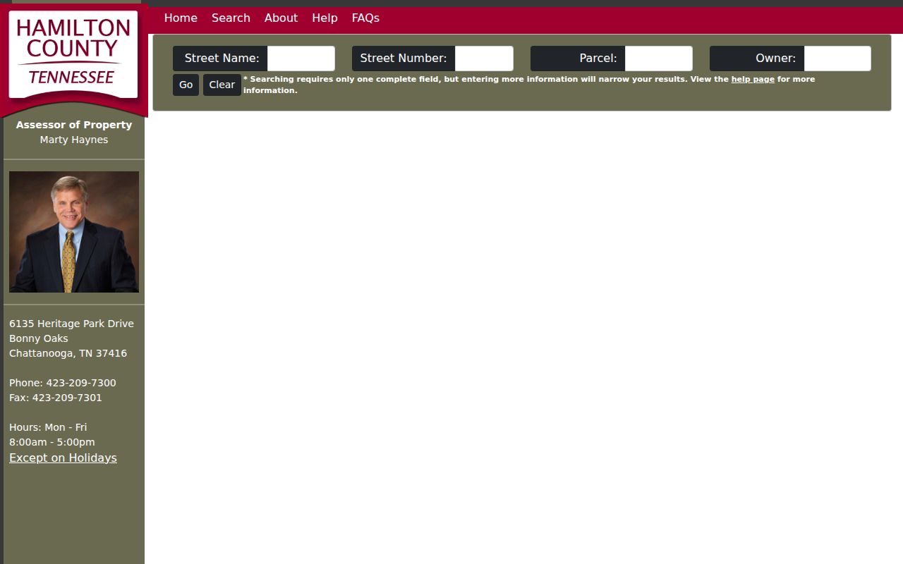
Chattanooga Assessor fields, Chattanooga street names, Chattanooga street numbers, Chattanooga parcel forms, Chattanooga owner entries, Chattanooga maps, and Chattanooga tax records should remain distinct in notes.
Use the displayed fields to narrow an address, then preserve the returned parcel reference before moving to tax, map, or deed records.
Read Chattanooga Street Records Separately
A property record has several address-like fields that should not be collapsed into one conclusion. The situs address is where the parcel or structure is located. A mailing address is where tax correspondence is sent. The legal description is the lot, block, subdivision, or metes-and-bounds wording in a recorded instrument. The Trustee's sample tax card shows property address, owner names, mailing address, district, and State Grid as separate data points. A mailing address can differ from the parcel, and neither field establishes who is present at an address.
- Parcel
- A county assessment unit that connects a property record to map and tax information.
- Situs address
- The location of the parcel or structure, distinct from the address used for tax correspondence.
- Plat
- A recorded map or plan for a subdivision or parcel arrangement that may be cited in a deed record.
- State Grid
- A location reference shown on the Trustee's documented sample tax card, alongside parcel and district information.
Hamilton County's downloadable Assessor extracts preserve street number, direction, name, suffix, unit, combined street address, map, group, parcel, State Grid, mailing fields, legal description, and sale references separately. The files refresh on a stated 30-day cycle, so retain the lookup or download date. Their structure is useful for a street directory comparison, but it remains an assessment record rather than a title opinion.
Chattanooga situs data, Chattanooga mailing data, Chattanooga parcel data, Chattanooga State Grid data, Chattanooga sale data, Chattanooga plat data, and Chattanooga map data serve different record purposes.
Map Chattanooga Streets in GISMO
Hamilton County Geospatial Technology publishes GISMO 5 and mapping products for address and parcel work. The official ZIMS User Guide documents address, owner-name, tax-map-number, and intersection workflows. After the map centers on the road, Identify Point can inspect visible layers at a point. Identify Area can assess visible layers within a drawn polygon. The result controls allow a reader to change the layer, move through returned features, zoom to a feature, open Table View, and access the Download menu.
A point or selected-parcel buffer is a spatial tool. It shows visible layers within a selected distance and can outline selected parcels in red. It does not make a household roster or prove that nearby properties have a personal connection. For address-format questions, the Assessor directs users to Geospatial Technology at 423-209-7760 or GIS@hamiltontn.gov, rather than relying on an old directory spelling.
Chattanooga GISMO searches, Chattanooga ZIMS layers, Chattanooga parcel points, Chattanooga address matches, Chattanooga intersection results, Chattanooga buffers, and Chattanooga Table View each describe map context.
Follow a Chattanooga Street Directory Deed Chain
Once a parcel card or sale reference supplies a book and page, the next record belongs with the Hamilton County Register of Deeds. Its online database is not an anonymous free index. Electronic access requires an application, payment, and login. The Register states a charge of $50 per firm, location, or individual each month. Account holders can use Party, Book and Page, Document, Property, Party/Property, Index, and Quick modes. Party mode requires a date range and defaults to July 1, 1969 through the present.
The Register's Quick Search draws sales information from the Assessor system to begin a title-chain workflow. It can help a reader build a sequence, but the office does not perform title searches or warrant a complete chain. A result marked “SEE MICROFILM” is not electronic. In that case, inspect records at 625 Georgia Avenue, Room 400, or use the office's phone, email, mail, or request-form route for a detailed request. The counter is open weekdays from 8:00 a.m. to 4:00 p.m.; the Register lists 423-209-6560.
The Register search login is pictured below. The screen's access choices are a reminder to choose the counter or request path when the paid web route does not fit the record needed.
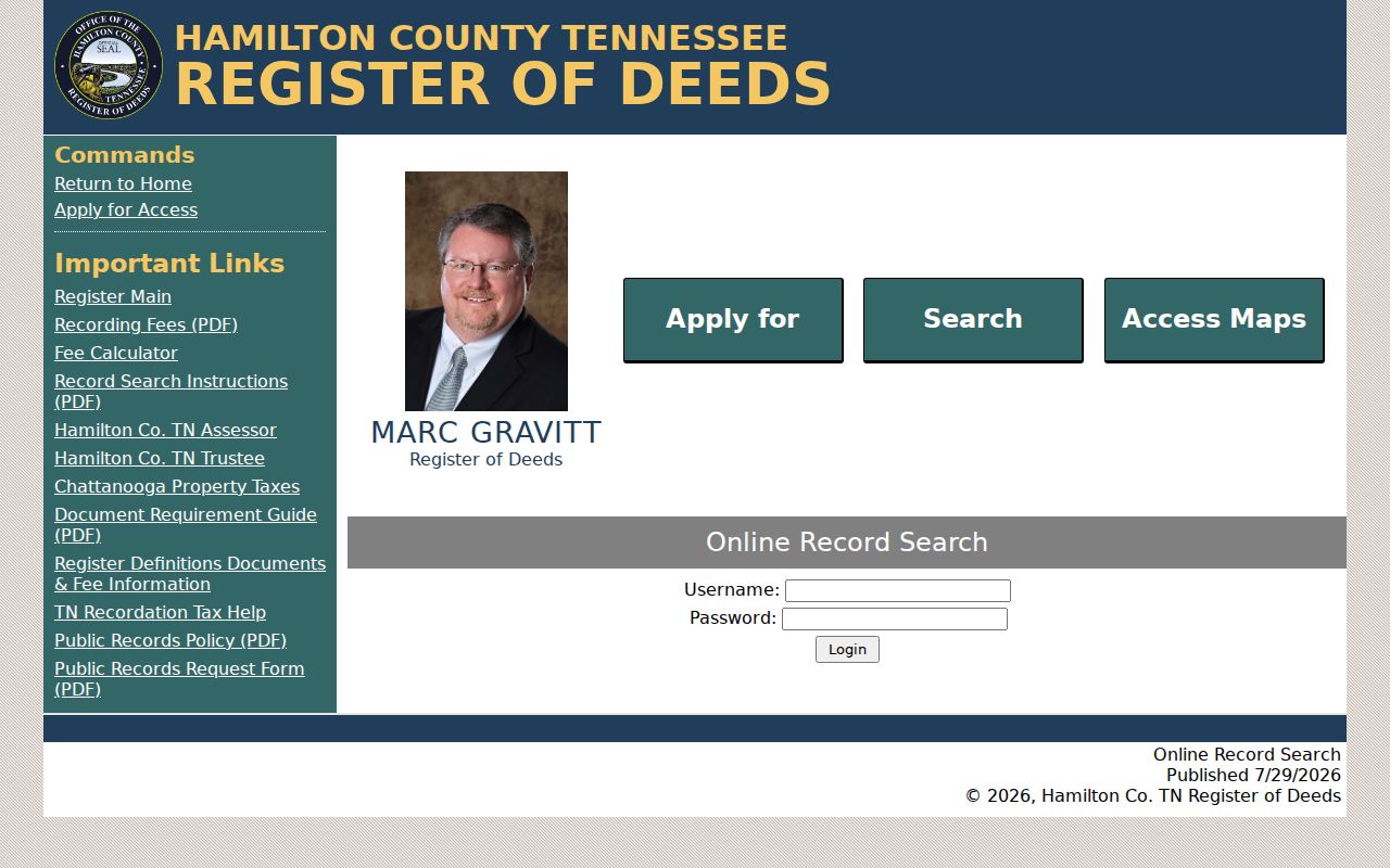
Chattanooga Register party results, Chattanooga Register book-and-page results, Chattanooga Register property results, Chattanooga Register Quick Search, Chattanooga microfilm, Chattanooga counter inspection, and Chattanooga request copies are distinct access paths.
Record both parties, the document date, book and page, and legal description when a document is available. A street number alone can change over time.
Chattanooga Address Records by Street
The records below are keyed to an address, parcel, or road segment, but their limits differ. Start with the record that matches the question. The Assessor and Trustee provide current property and tax context. GIS supplies spatial context. The Register supplies recorded-instrument context. City and library material can date a project or a past listing. No one row supplies a verified list of everyone connected to a road.
| Address source | Hamilton County or Chattanooga method | What it can show | Access path |
|---|---|---|---|
| Assessment roll | Street-only or street-plus-number Assessor search | Parcel and owner-indexed property details | Free web search or Assessor counter |
| Tax roll | Map/group/parcel, last name, bill number, or property address | Tax-record address, owner names, mailing address, district, and grid | Trustee inquiry, downloads, or counter |
| GIS parcel map | GISMO/ZIMS address, owner, tax-map, identify, or area tools | Parcel locations and visible map layers | Public mapping tools |
| Recorded instruments | Book/page, party, property, index, or Quick Search | Recorded parties, instruments, plats, and legal-description trail | Paid account, counter, or request |
| Permit or code file | Land Development portal or precise City records request | Address and date-specific project or compliance material | Portal, counter, or City request route |
Chattanooga assessment records, Chattanooga tax records, Chattanooga GIS records, Chattanooga deed records, Chattanooga permit records, Chattanooga directory records, and Chattanooga election resources have different access limits.
Hamilton County Trustee Property Tax Inquiry shows the documented tax-search entry routes used in a Chattanooga street directory search.
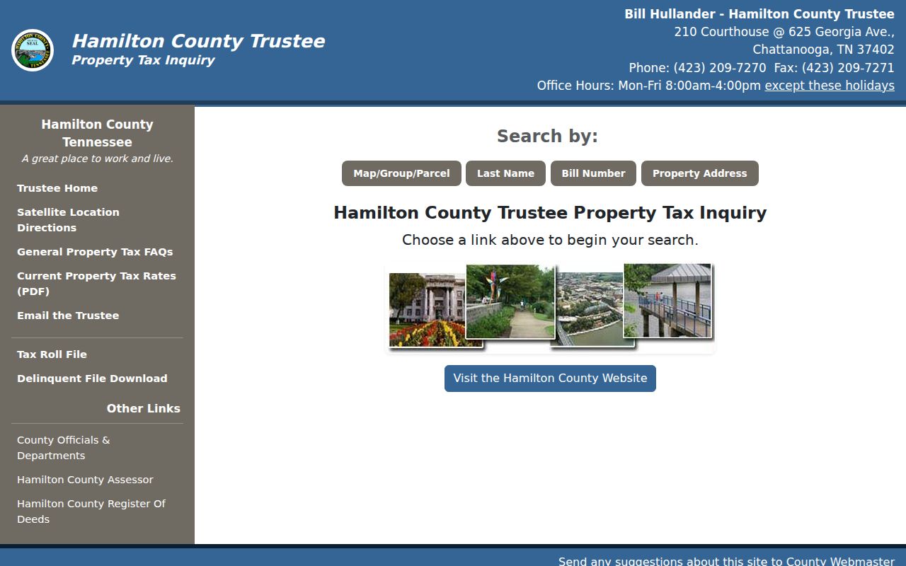
The Chattanooga Trustee screen reinforces why property, owner, tax, and mailing fields must be read separately along the same street.
Hamilton County Election resources are not a street browser. The state voter lookup uses county, name, and birth month and year; Hamilton's individual form requires a last name, last four Social Security digits, and full date of birth. A voter-list order has separate statutory certification rules. Do not use either route as a street-wide roster.
Chattanooga Street Permits and Records
For a physical-change or compliance question, use the City path that is tied to the address and period at issue. Chattanooga's Land Development Office handles zoning, building-plan review and inspections, subdivision and plat review, code enforcement, and trade permits. Its Development Resource Center is at 1250 Market Street, Suite 1000, and the office lists weekday hours from 8:00 a.m. to 4:00 p.m. Permit processing at the counter stops after 3:30 p.m.
A free OpenGov login is required for the City’s Building Code Compliance Letter route. That request concerns a property's compliance information, not a general permit-history browser. When a portal provides no display, make an address-and-date-specific request through the Chattanooga Open Records Center. Include the record type, street address, date range, and whether inspection or copies are wanted. A permit applicant or a service-request contact is not proof of a current household connection.
Chattanooga Land Development, Chattanooga OpenGov, Chattanooga code records, Chattanooga permit files, Chattanooga inspection files, Chattanooga City requests, and Chattanooga address dates all help identify the proper record path.
Note: A City records request should describe existing address files, because the Tennessee Public Records Act does not require a custodian to create a new street compilation.
Chattanooga Streets in Older Directories
Chattanooga Public Library's Local History and Genealogy collection holds city directories from 1871 through 2008. Volumes before 1938 are on microfilm. The library identifies gaps for 1873 through 1875, 1877, and 1879, so a missing year is a collection gap rather than a clean finding. The 1871 through 1960 run is available through Ancestry Library Edition at all Chattanooga Public Library branches. A dated volume can place a listed person at an address in that edition, but its abbreviations and fields vary by publisher and year.
Search the Local History and Genealogy Department with the road, a neighborhood, and the edition date. Its physical collection also includes maps, plats, newspapers, clipping files, and local photographs. The Library's house-history guide advises comparing nearby editions and other sources. For a long historical address trail, the Chattanooga city directory collections give the fuller holdings and access detail.
Chattanooga directory volumes, Chattanooga microfilm, Chattanooga branch access, Chattanooga maps, Chattanooga plats, Chattanooga newspapers, and Chattanooga photographs can each date a road differently.
Chattanooga Street Labels Through Annexation
Postal city labels and historical locality names need care in a street directory search. Chattanooga annexed St. Elmo, Missionary Ridge, Alton Park, North Chattanooga, Brainerd, and Riverview in 1929, doubling the city’s size. An older directory, newspaper, permit, or deed reference may therefore carry a community name that does not match the modern City of Chattanooga label. Preserve the directional prefix, suffix, community name, and parcel reference before trying variants.
The county's Regional Addressing Policy adopts USPS Publication 28 conventions and provides an appeal path. The research did not verify a single historic citywide renumbering or grid zero point. The sound local method is to compare name, direction, suffix, legal description, historic map, and date-specific directory evidence. A postal ZIP is a routing label, not a replacement for those address records.
Chattanooga annexation labels, Chattanooga street names, Chattanooga suffixes, Chattanooga directions, Chattanooga parcel references, Chattanooga maps, and Chattanooga directories should be compared before a historic match is accepted.
Limits of a Chattanooga Street Directory
Property and tax results identify assessed or recorded relationships, not a complete account of private household membership. A parcel owner may not be present at the situs address. A tax mailing address may be only a correspondence destination. GIS parcels are not survey-grade proof of legal ownership, and the Register's index is not a title examination. DMV data is restricted by the federal Driver’s Privacy Protection Act, utility customer lists are not a general public roll, and protected, sealed, juvenile, and Safe at Home information may be unavailable.
Chattanooga parcel records, Chattanooga tax records, Chattanooga map records, Chattanooga Register records, Chattanooga City files, Chattanooga Library material, and Chattanooga protected-address limits require careful reading.
Lawful use. Use Chattanooga address records for personal, lawful research and confirm important facts with the custodian. Do not use a record trail to stalk, harass, intimidate, or expose a protected person.