
Chattanooga ZIP Code Directory Areas
Postal labels in Chattanooga need an address-by-address check. The United States Postal Service treats a ZIP as a delivery-routing label, while city limits, parcel boundaries, council districts, and neighborhood shapes come from different sources. The table preserves the research's local working descriptions, not a promise that every address in a listed ZIP lies in Chattanooga. The standard ZIPs below are useful for orienting an address before a USPS confirmation. Special-use and institutional entries remain especially important to verify before relying on them.
| ZIP code | Chattanooga-area use | Postal locality | Verification note |
|---|---|---|---|
| 37401 | Downtown post-office or special mailing use | Chattanooga | Confirm delivery or post-office use with USPS. |
| 37402 | Downtown and civic-core mailing use | Chattanooga | Government and courthouse office addresses use this ZIP. |
| 37403 | Downtown, UTC-adjacent, and central-city mailing use | Chattanooga | Confirm the exact street address. |
| 37404 | East-central and Highland Park vicinity | Chattanooga | Use a street-level USPS result. |
| 37405 | North Chattanooga, North Shore, and Signal Mountain-area use | Chattanooga | The postal label can cross jurisdiction context. |
| 37406 | East Chattanooga and Amnicola vicinity | Chattanooga | The Election Commission's River Terminal Road address uses this ZIP. |
| 37407 | East Lake and Rossville Boulevard vicinity | Chattanooga | Verify the address and jurisdiction separately. |
| 37408 | Southside and Main Street vicinity | Chattanooga | Does not establish a development-district or city status. |
| 37409 | St. Elmo and Lookout Mountain-side vicinity | Chattanooga | Historic locality and date can matter. |
| 37410 | Alton Park and south Chattanooga vicinity | Chattanooga | Check the actual street address. |
| 37411 | Brainerd and Missionary Ridge-side vicinity | Chattanooga | Neighborhood Services uses this ZIP. |
| 37412 | East Ridge mailing locality | East Ridge | Do not treat it as a Chattanooga city conclusion. |
| 37414 | East and southeast Chattanooga vicinity | Chattanooga | Verify each address. |
| 37415 | Hixson and north-county mailing locality | Hixson | Often outside Chattanooga city limits. |
| 37416 | Bonny Oaks, Tyner, and east-county vicinity | Chattanooga | County and city boundaries can differ here. |
| 37419 | Lookout Valley and west Chattanooga vicinity | Chattanooga | Confirm through USPS. |
| 37421 | East Brainerd and Tyner vicinity | Chattanooga | City and county record jurisdiction may differ. |
| 37422 | Reported special or post-office-box use | Chattanooga | USPS validation is still needed. |
| 37450 | Institutional or unique use associated with UTC | Chattanooga | Confirm the current special-use rule and delivery relation. |
Downtown Station, Eastgate, South Station, Highland Park, North Chattanooga, East Chattanooga, Red Bank, and Murray Lake Hills appear as postal-area labels in the countywide GIS ZIP layer. They help orient a search but do not define a parcel, a municipal line, or a community-association boundary.
Chattanooga Downtown Station, Chattanooga Eastgate, Chattanooga South Station, and Chattanooga Highland Park are postal-area labels, not City-limit findings.
Verify a Chattanooga ZIP Code First
The USPS ZIP Code Lookup is the final official check for one street address. A durable citywide USPS results page was not available in the research, so use the live result for the address in hand rather than copying a ZIP from a neighborhood label. The result is a postal verification. It does not identify a parcel owner, establish city jurisdiction, or confirm anyone's connection to the address. Preserve the formatted address and lookup date before continuing to a public record.
| Check | What the ZIP code result can settle | What it cannot settle |
|---|---|---|
| Complete street address | The delivery ZIP associated with the queried address | City-limit status, parcel boundary, or ownership |
| Postal locality label | The postal naming used for the result | The incorporated municipality for every address sharing the label |
| Lookup date | When the postal result was checked | Whether a historic source used the same postal geography |
The official USPS lookup shown below should be used one address at a time. That is more reliable than assigning a ZIP from a broad area name.
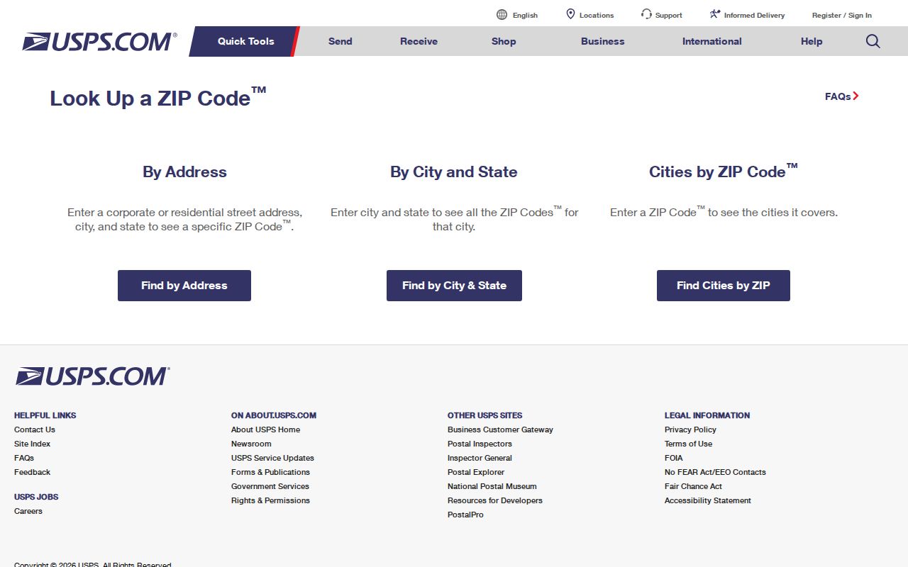
Chattanooga USPS results, Chattanooga street addresses, Chattanooga postal labels, and Chattanooga lookup dates should be retained together.
After confirming the delivery ZIP, carry the full address into county tools that accept an address or parcel reference.
Chattanooga ZIP Codes and City Limits
A Chattanooga mailing address is not always an incorporated-Chattanooga address. Hamilton County is the principal county for the city, yet postal use reaches nearby incorporated and unincorporated places. ZIP 37412 is an East Ridge mailing locality, while 37415 serves Hixson and north-county territory and is often outside the city. The 37405 and 37416 descriptions also carry jurisdiction cautions. Conversely, a City address may use a historical locality label that differs from a current municipal name.
The strongest local geography lesson is that four boundaries can coexist: postal ZIP polygons, City limits, community-association shapes, and historic annexation labels. In 1929, Chattanooga annexed St. Elmo, Missionary Ridge, Alton Park, North Chattanooga, Brainerd, and Riverview, doubling the city's size. Older directories, deeds, permits, and newspapers may use the earlier community name. Keep that label in a historical search even after a USPS result supplies today's postal orientation.
Chattanooga ZIP polygons, Chattanooga City limits, Chattanooga association maps, and Chattanooga historic localities are separate geographies.
Boundary check. For an unclear road name or street number, Hamilton County Geospatial Technology is the local map contact at 423-209-7760 or GIS@hamiltontn.gov.
Why a Chattanooga ZIP Code Roll Is Not Available
No verified local public-record portal in the research provides a ZIP-wide people or property roll. The Assessor form searches Street Name, Street Number, Parcel, or Owner. The Trustee form searches Map/Group/Parcel, Last Name, Bill Number, or Property Address. GISMO/ZIMS documents address, map, and owner searching plus spatial layers, but not a ZIP filter. The Register offers party, property, document, index, book-and-page, and Quick modes, but no documented ZIP field. Those limits are important because a postal code is not a substitute for the record's own indexing method.
| Local record route | Documented entry choices | ZIP-wide result? | Best use after USPS verification |
|---|---|---|---|
| Assessor Property Search | Street Name, Street Number, Parcel, Owner | No documented ZIP field | Find a parcel or street-matched assessment record. |
| Trustee Property Tax Inquiry | Map/Group/Parcel, Last Name, Bill Number, Property Address | No documented ZIP field | Compare tax-record property and mailing fields. |
| GISMO/ZIMS | Address, owner, tax map, intersection, identify, selection | No documented ZIP filter | Locate a verified address and inspect visible parcel layers. |
| Register of Deeds | Party, Book and Page, Document, Property, Index, Quick | No documented ZIP filter | Follow a recorded instrument from parcel or sale references. |
Chattanooga Assessor fields, Chattanooga Trustee fields, Chattanooga GISMO fields, and Chattanooga Register fields are indexed without a ZIP-only search.
For a neighborhood-sized question, first verify a street address with USPS, then use the Assessor or Trustee at that address. The Chattanooga street directory has the full address-to-parcel and deed sequence.
Hamilton County Assessor Property Search shows the four field types available after a Chattanooga ZIP code has been narrowed to an actual address.
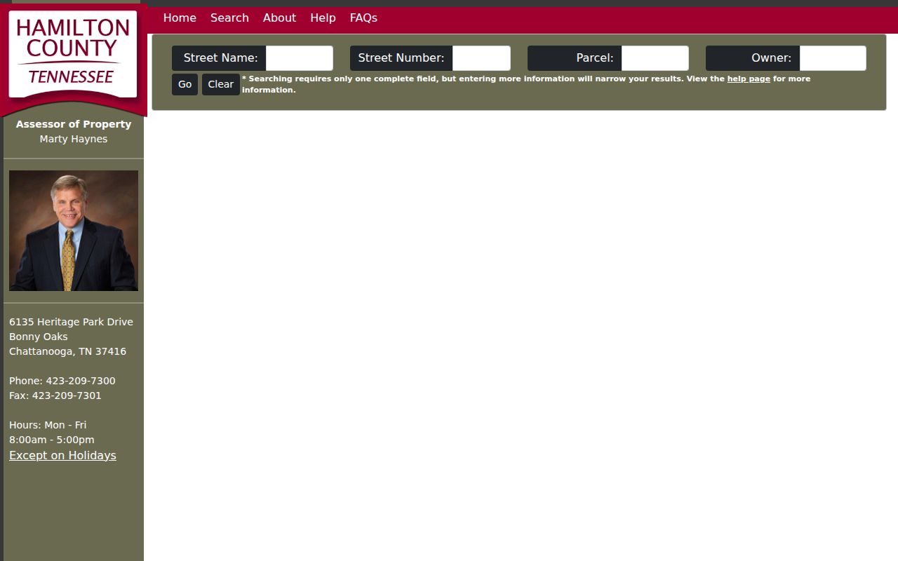
The Chattanooga Assessor screen confirms that a street, number, parcel, or owner field is needed because the local search does not accept a ZIP-only query.
Chattanooga ZIP Code Directory Tax Search
The Trustee's property tool is helpful after, not before, postal verification. It accepts a known Property Address along with Map/Group/Parcel, Last Name, and Bill Number. The documented page does not take a ZIP-only query. It can return tax-record context such as a property address, owner names, mailing address, district, and State Grid. That information should be read as a tax record. A mailing address can be a correspondence endpoint and does not establish who is at the property.
The Trustee Property Tax Inquiry screen below makes the entry choices visible. Its office reports that past tax records and delinquent tax records can be downloaded or viewed. The Trustee is at 625 Georgia Avenue, Room 210, with weekday hours from 8:00 a.m. to 4:00 p.m.; the office lists 423-209-7270.
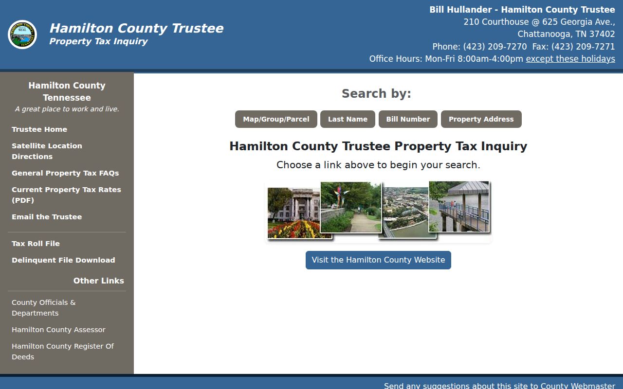
Chattanooga Trustee addresses, Chattanooga State Grid references, Chattanooga owner fields, and Chattanooga mailing fields need separate interpretation.
Use the returned address or parcel data to compare official record fields, rather than treating the tax tool as a search for people within a ZIP.
Chattanooga ZIP Code Directory Neighborhood Maps
Neighborhood association geography adds civic context but is not a postal or legal boundary. Chattanooga Neighborhood Services supports association registration, a public map, a published association list, a handbook, and district staff. The City's underlying association map service has 104 active features with public fields limited to display name, status, and map link. The boundaries are defined by community members and are informational, not survey or City-limit lines.
The Neighborhood Associations page shown below can help identify a civic association and City liaison after an address has been located. It does not publish a membership directory, and an association name is not evidence that a particular person is connected to an address.
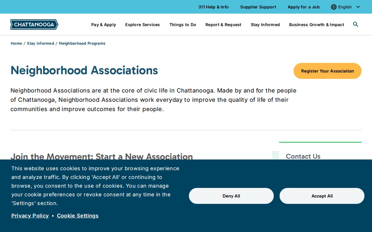
Chattanooga association features, Chattanooga association status, Chattanooga association maps, and Chattanooga City liaisons provide civic context only.
Use the City association map for participation and area context, while relying on the City jurisdiction layer or county parcel tools for the relevant boundary question.
Chattanooga ZIP Code Records Requests
A ZIP-wide request needs a defined existing record set. City permits and the Open Records Center are keyed to an address or project. The Tennessee Public Records Act does not require a custodian to create a new custom ZIP compilation. Name the office, record type, fields sought, date span, geographic description, and whether inspection or copies are wanted. That level of detail lets the custodian determine whether an existing responsive record can be inspected, copied, or must be withheld or redacted.
The Register permits detailed requests by phone, email, mail, or form and states that ordinary open records can be inspected during counter hours. For older county material, the Tennessee State Library and Archives lists Hamilton County in its county-record microfilm inventory. Use the counter, a targeted request, or the archive rather than assuming a ZIP search screen holds all historical material.
Chattanooga City requests, Chattanooga Register requests, Chattanooga archive microfilm, and Chattanooga address records each need a defined record description.
Note: A postal ZIP narrows an address question, but the named custodian and its record index determine what can actually be searched.
Chattanooga ZIP Code Terms and Limits
Postal and property terms answer different questions. A modern ZIP can orient a present address, while historical directories and maps are normally arranged by street, locality, or ward. For an older address, search the historic road and community name first, then use a modern USPS result only as an orientation aid. Parcel, tax, and deed searches should continue to use the fields documented by their custodians.
- ZIP code
- A postal delivery-routing label; it does not define a city limit, parcel, or council district.
- ZIP+4
- An added postal routing detail associated with a more specific delivery segment than the base ZIP.
- Post-office-box ZIP
- A ZIP associated with post-office-box or special mailing use; confirm its current use with USPS.
- Unique ZIP
- A special postal assignment associated with one institution or organization, such as the UTC-associated 37450 entry that still needs current USPS confirmation.
- Carrier route
- A delivery-route grouping used by the postal system; it is not a public record of property ownership or private household membership.
Chattanooga historic streets, Chattanooga directories, Chattanooga maps, and Chattanooga USPS labels should not be treated as the same geographic record.
Records can be useful for family history, estate questions, civic research, or correcting a record at its custodian. They should be treated with care. Safe at Home protections, sealed records, juvenile material, and other restrictions can limit access, and no ZIP or map result should be used to expose a protected person.